
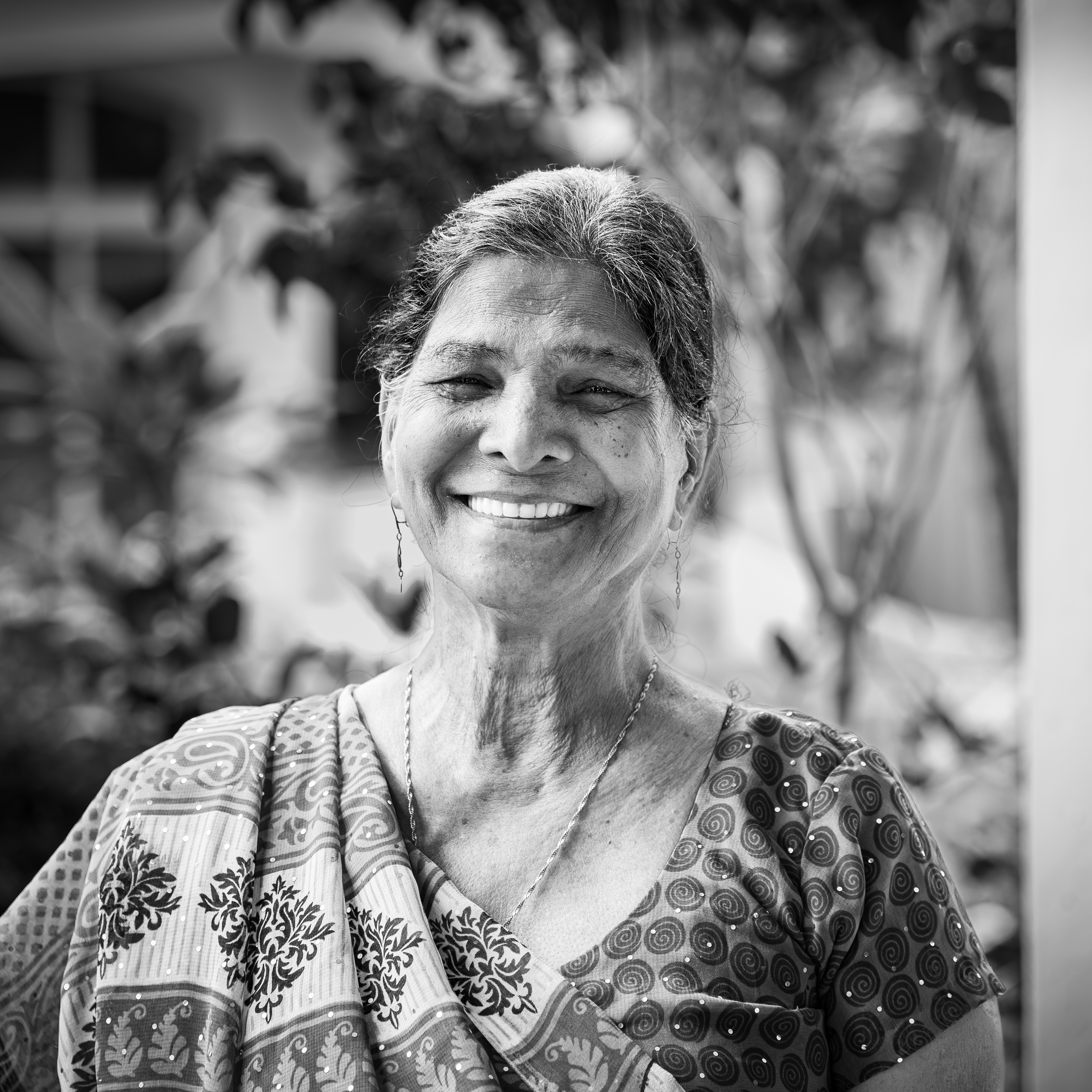
The association “De loin et/ou de près” presents at the “Aux Docks d’Arles” gallery
“Dilo Dibout? Ile Maurice.Mauritius,” an exhibition featuring:
Antonin Lainé, Frédérick Bréville (photographers), and Elsa-Xuân Lainé (geographer).
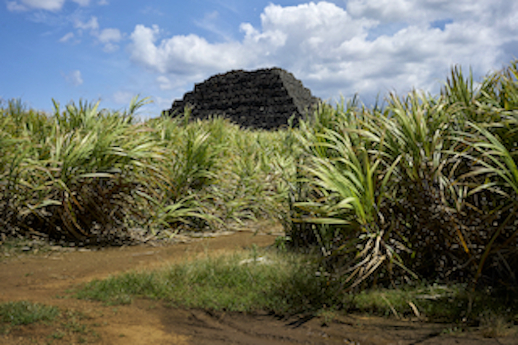
Through some fifty color and black-and-white photographs and accompanying texts, the exhibition offers an overview of the island’s changing landscapes, industrial heritage, and living memory linked to the sugarcane culture in Mauritius. This exhibition invites the public to discover little-known regions of the island, away from the coast.
The Republic of Mauritius, independent since 1968, is an archipelago in the Indian Ocean whose main island is home to 1.2 million inhabitants on an area of 1,864 km², measuring approximately 65 km by 45 km. Like its “sister island,” Réunion, it remained unknown and uninhabited for a long time before the arrival of the first Arab, Portuguese, and then Dutch sailors. In 1715, the French seized it and named it Isle de France; in 1810, British troops established control there, a conquest confirmed in 1814 by the Treaty of Paris. From then on, sugarcane became one of the mainstays of the Mauritian economy. After the abolition of slavery in 1835, this industry—which required a large workforce—continued with the arrival of indentured laborers, who were paid under contract and came primarily
from India.
Until the early 1970s, sugarcane occupied 90% of arable land—or 84,000 hectares—in Mauritius, before gradually declining over the decades to 35,000 hectares by 2024. This decline can be attributed in part to the end of the sugar protocol with the European Union in 2009, but also to the country’s determined policy of economic diversification: tourism, manufacturing, new information technologies, telecommunications, and real estate.
While sugarcane serves as the central thread of the narrative presented here, the aim is not to recount the history of the sugar industry but to provide a current overview at a stage of structural—and likely irreversible—transformation of the region, and to give voice to those who embody and participate in the collective history of Mauritius.
Since every landscape is shaped and perceived through the lens of history and culture, the sugarcane fields and their landmarks remain a powerful symbol of the territory, the collective imagination, and living memory. At this pivotal moment, when these transformations are gradually erasing or obscuring the traces of this past, documenting this heritage is a way to pass on a chapter of the island’s industrial and human history.
Languages spoken
-
French

Documents to download

Go by bike
Average travel time from:
- Arles (downtown)
- Saintes-Maries-de-la-Mer
- Port-Saint-Louis
- Les Salins-de-Giraud